
STORE — Resource Modelling Upstream of the power plant of La Dernier
- Live, STREAM
STORE is a major Innosuisse Flagship project coordinated by HES-SO Valais-Wallis, bringing together 13 industrial partners and 4 academic partners to design the energy storage infrastructure needed for 100% renewable production in Switzerland. WP1 Hydropower explores the flexibility and storage capacities of hydropower. STREAM’s contribution focuses on Test Case 1 and the La Dernier power plant (Romande Energie), which focuses on the use of batteries to reconcile hydropeaking constraints and production.
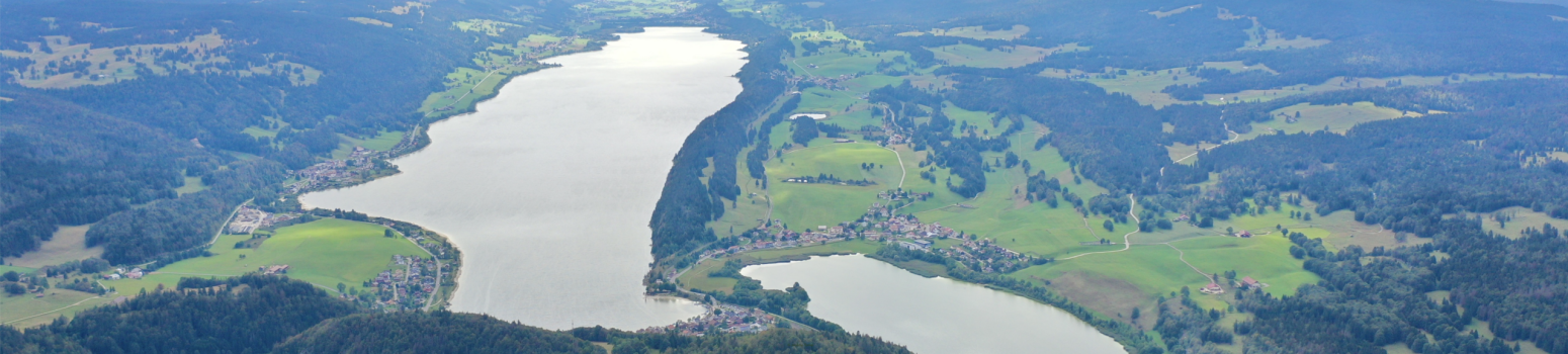
In this context, STREAM contributes hydrological expertise: modelling the Lac de Joux and Lac de Brenet (upstream of the power plant, see Figure 1) to estimate the evolution of the turbine-available resource under climate change, including droughts and floods, and its impact on production.
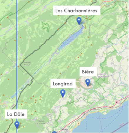
Figure 1 : The meteorological stations used for hydrological modelling
Results
Hydrological Modelling with RS MINERVE
The Lac de Joux catchment was modelled using the RS MINERVE software. The two lakes were modelled as a single reservoir. The catchment was divided into four sub-catchments hillslopes and 200 m elevation bands to better represent snowmelt.
The hourly calibration (2015–2020, validated on 2021–2022 and then tested up to 2024) yields good results: Nash coefficient of 0.68 at La Frontière and 0.72 at Le Sentier.
Resource Projections
Historical annual production is strongly correlated with annual rainfall (81%) and the flow of the Orbe at Le Sentier (94%), making it possible to roughly estimate future production from projected flows.
Fed by the CH2018 climate scenarios, the model indicates a slight increase in annual precipitation but a decrease in summer resources, attributed to increased evapotranspiration: at Le Sentier, the most pessimistic scenario (RCP 8.5) projects an average decrease of 0.5 m³/s in summer by end of century (2070–2099) (see Figure 2).
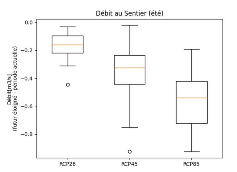
Figure 2 Change in mean flows (season: summer) at Le Sentier from 1981–2012 to 2070–2099, according to the three scenarios
We are currently updating the models to better account for infiltration in this karstic environment, which creates an underground river with a resurgence downstream of the Lac de Brenet. We hope that the lake hydrological model will yield better results, making it possible to subsequently test different operating scenarios for the power plant.
Flood Evolution
Generative AI methods (GAN) have been developed to generate hourly climate data at the stations of interest, from data available only at the daily scale (see Project Stochastic Generation of Hourly Meteorological Time Series). These hourly data, combined with the hydrological model described above, reproduce the high flows of the Orbe at Le Sentier better than other methods (linear interpolation or random sampling), with a lower Wasserstein distance on flows (0.020 m³/s). This work will enable a better estimation of future flood evolution.
Who is working on this project now?
- STREAM / HES-SO Valais-Wallis (F. Terrettaz, F. Mettra, E. Neveu)
- Romande Energie
- Collaboration HydroAlps Lab (HAL)
Funding
Innosuisse Flagship (grant agreement no. 108.230)